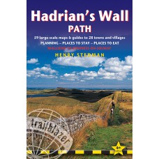
Hadrian's Wall Path
Wallsend (Newcastle) to Bowness-on-Solway
Hadrian's Wall Path, 84 miles from end to end, follows the course of northern Europe's largest surviving Roman monument, a 2nd-century fortification built on the orders of the Emperor Hadrian in AD122 and now listed as a UNESCO World Heritage Site. The path crosses the beautiful border country between England and ScotlandThis week-long walk is regarded as one of the least challenging yet most rewarding of the National Trails.
The fourth edition is fully updated and rewalked. Includes accommodation, pubs and restaurants in detailed guides to 29 towns and villages.
- Includes 59 detailed walking maps: the largest-scale maps available. At just under 1:20,000, these maps are bigger than even the most detailed walking maps currently available in the shops.
- Unique mapping features - walking times, directions, tricky junctions, places to stay, places to eat, points of interest. These are not general-purpose maps but fully edited maps drawn by walkers for walkers.
- Itineraries for all walkers - whether hiking the entire route or sampling highlights on day walks on short breaks.
- Practical information for all budgets What to see; where to eat (cafés, pubs and restaurants); where to stay (B&Bs, hotels, bunkhouses, hostels and campsites).
- Includes downloadable GPS waypoints.
| Book Details | |
| Title | Hadrian's Wall Path |
| Subtitle | Wallsend (Newcastle) to Bowness-on-Solway |
| Book Series | British Walking Guides |
| Author | Henry Stedman |
| Publisher | Trailblazer Publications |
| Edition | 4th Edition |
| Release Date | June 2014 |
| Language | English |
| Cover | Paperback |
| Map Details | 59 Large scale walking maps at just under 1:20,000 |
| Printed Pages | 244 Pages |
| Size | 18.0cm x 12.0cm x 1.6cm |
| Postal Weight | 325g |
Hadrian's Wall Path | Wallsend, Newcastle to Bowness-on-Solway
- Company: Trailblazer Publications
- Product Code: TBZ HAD WAL PTH
- Availability: In Stock
-
€13.95
- Ex Tax: €13.95

