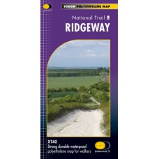
Ridgeway
National Trail Map | XT40 Map Series
Entire route on one map.
Ridgeway National Trail is 137km (85 miles).
From Overton Hill near Avebury in Wiltshire to Ivinghoe Beacon, east of Tring in Hertfordshire 137km (85 miles).
- Tough, light, durable and 100% waterproof
- Includes Rights of Way
- Genuine original HARVEY mapping
- Route clearly marked
| Map Details | |
| Title | Ridgeway |
| Map Detail | 1:40,000 |
| Map Series | National Trail Map | XT40 Map Series |
| Publisher | Harvey Maps |
| Release Date | 2015 |
| Size | Folded: 11.5cm x 24.5cm / Unfolded: 97.2cm x 70.0cm |
| Postal Weight | 100g |
Ridgeway | National Trail Map | XT40 Map Series
- Company: Harvey Maps
- Product Code: HRV-XT40-RDG
- Availability: In Stock
-
€16.95
- Ex Tax: €14.93

