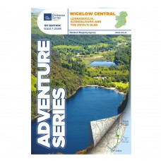
Wicklow Central | Lugnaquillia, Glendalough and the Devil's Glen
Adventure Series | 1:25,000
Wicklow Central is part of a mini-series of three Wicklow Uplands maps which in turn are a subset of the Adventure Series by Ordnance Survey Ireland. The map is drawn to a scale of 1:25,000 and covers an area of 32km x 17km. It is printed on both sides of water resistant paper with a 2km overlapping section.
Map Includes
- Clara Vale Trails
- Devil's Glen
- Glendalough Trails
- St Kevin's Way: Hollywood & Valleymount - Glendalough
- Vartry Reservoir
- Wicklow Way: Ballinastoe - Glendalough - Glenmalure - Slieve Maan
- Wicklow Mountains National Park
| Map Details | |
| Title | Wicklow Central |
| Subtitle | Lugnaquillia, Glendalough and the Devil's Glen |
| Map Detail | 1:25,000 |
| Map Series | Adventure Series |
| Publisher | Ordnance Survey Ireland |
| Edition | 1st Edition |
| Release Date | 2015 |
| Finish | Water Resistant |
| Size | Folded: 17.5cm x 11.0cm x 0.5cm |
| Postal Weight | 95g |
OSI Adventure Series | Wicklow Central | Lugnaquillia, Glendalough and the Devil's Glen
- Company: Ordnance Survey Ireland
- Product Code: OSI AS WICK CENT
- Availability: In Stock
-
€13.00
- Ex Tax: €11.45
Related Products
The Wicklow Way Map Bundle | 1:25,000 Adventure Series
The Wicklow Way Map Bundle Adventure Series | 1:25,000 NB: This set of maps only covers 119km of the Wicklow Way walking trail from Marlay Park to Shillelagh! The final section of trail to Clone..
€35.00 €39.00 Ex Tax: €30.84


